Thursday, September 25, 2008

Forts, hills and a great writer...

ദൈവത്തിന്റെ വികൃതികള്‍, മയ്യഴിപ്പുഴയിടെ തീരങ്ങളില്‍... ഈ കൃതികള്‍ വായിച്ചവര്‍ക്ക് മയ്യഴി എന്ന സഥലം പെട്ടെന്ന് മറക്കാന്‍ കഴിയില്ല... അങ്ങനെയിരിക്കെ ചേട്ടന്റെ കൂട്ടുകാരായ രവീന്ദ്രന്‍ മാഷും, ഉണ്ണിയും പിന്നെ ഷിബുച്ചായനും ഒരു മയ്യഴി യാത്രയെപ്പറ്റി പറഞ്ഞു... പിന്നെ കൂടുതല്‍ ഒന്നും ആലോചിച്ചില്ല... ഞാനും ശ്യാമും ആഷിക്കും കണ്ണൂരിന് ടിക്കറ്റ് ബുക്ക് ചെയ്തു...

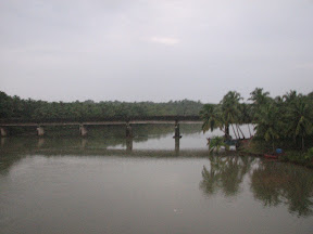
But ironic as it may seem, Raveendran mash and Unni never made the trip. And though we did, all we saw of Mayyzhi was the railway station and a bridge across the Mayyazhi river...


We reached Kannur on Saturday morning and went directly to our Sudeep's place. After a quick shower and a delicious breakfast of appam and kadala curry, we started out for Bekal in Sudeep's car. On the way, we stopped at a clinic to get Shibuchayan urgent medical attention (He had injured his finger in an encounter with a bull... A dead one, that is... Yeah you guessed right... He cut his arm while cutting meat!). After half an hour, three local anaesthetic injections and a washroom full of puke later, he was ready to go.

The drive to Bekal was pleasant, except for the bad roads here and there. We saw the entrance to the "Vismaya Infotainment Park", set up by the pro-CPM Malabar Tourism Development Co-operative. We decided to spend time and money on better things. Shibuchayan had a strange idea of having kappa and beef from from "ഷര്‍ട്ടിടാത്ത അപ്പച്ചന്റെ കട", and we we were on the look out for a place matching the requirement. Sadly, we couldn't find any and so we had lunch from a small hotel at Bekal. We were lucky to get anything at all, because it was almost 3 and I can say without much exaggeration that we finished everything they had to serve!


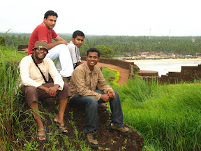
The fort is maginificent and is maintained reasonably. It is was built in 1565 and history buffs, read more about the fort here.


We couldn't help but imagine brave soldiers standing guard day and night at the watch towers. A large area of the fort is covered by lush green grass which makes it more beautiful than most other forts. If you happen to be near Kasargod, Bekal is a must see.


On the way back from Bekal, we also visited Parassinikkadavu temple. It was too crowded and so we couldn't even go near the "muthappan". We were a bit disappointed but later, when Sudeep told us that he'll speak out all our darkest secrets if we touched him, I was convinced that everything happens for good!


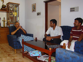
By the time we reached Sudeep's place, his dad had arranged fresh കള്ള് for us. It is one of the most refreshing and tasty drinks I've ever tried. Wish I could find a way to keep കള്ള് sweet for a longer time... It's got great potential as an energy drink! There was also a brief singing session, which was kind of a tradition for Sudeep's family.

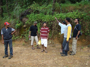
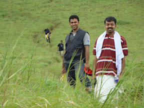
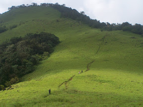
It was a long day and we all slept like logs (Which we do even otherwise.. he he) in preparation for next day's trek. A trek to Paithalmala was planned on Sunday. Nobody knew much about the place but we took a chance and decided to go. We hired a jeep to get there, around 30 km from Kannur.

The trek was pretty easy, for just around 1.5 km. The route was infested with leech, as we expected, and it took me so long to publish this because I couldn't scratch and type at the same time!!


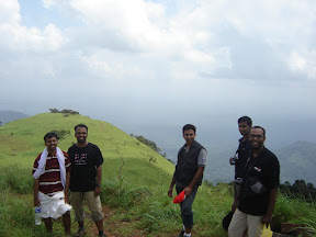
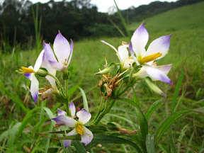
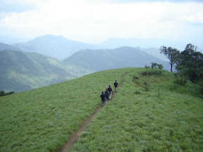
Paithalmala is surrounded by meadows and looks absolutely lovely. There is a watch tower with a great view. We had our lunch there enjoying the cool breeze.


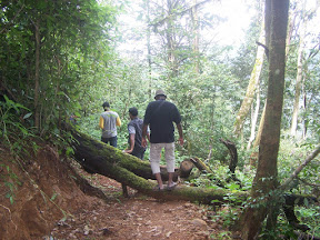
Our next stop was the suicide point. We took a wrong turn and ended up taking the trail less travelled. It was a bit steep, but we reached the cliff very soon.


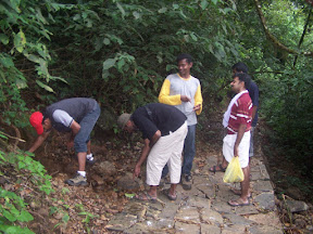
Before starting the trek, we were told by the locals that there was water available on the top, but we didn't know that they meant a small, stagnant pool of water half filled with grass. We had to decide against drinking from it and trekked back thirsty till the next stream, which was aroung a kilometer downhill.


We reached Kannur by 6 and didn't have time for anything else since our train was at 8. Me, Syam and Ashik left that day, but my brother and Shibuchayan stayed. They went to a nearby island on Monday and on to Mayyazhi on Tuesday.


Like many of our contacts in Kannur warned there was not much to see in Mayyazhi.


They went around asking for places where the French used to stay and all they got were cold stares and an occasional laugh. Finally, someone was kind enough to direct them to Mukundan himself.


Apparently, all the roads were renamed and most of the old buildings demolished and reconstructed. No attempt was ever made to preserve anything from the old days. Even the bunglows under government control were out of luck.

Photos: Sudeep, Ashik, Syam

To watch all the photos, visit


Sunday, August 3, 2008

Around Idukki in a Day!

It all started when we heard reports of a Neelakurinji bloom in Idukki, at a place called Pooppara. For the uninitiated who are also too lazy to read the Wikipedia entry, Neelakurinji blooms occur once in twelve years and are supposed to cover entire hillsides, providing a breathtaking view.

So me, David and Vizzy started from Mavelikkara on Saturday morning. We decided to take the Kuttikkanam - Kattappana route. The roads are really nice and the whole area is so beautiful the drive alone would've made the trip worth it!


The town of K Chappath. Anybody know what the "K" stands for?


The low bridge at K Chappath. Was probably a Chappath long back.


Since we didn't have any fixed plans, we decided to visit the Idukki dam too. (Being the electrical engineer I am, couldn't resist call of the Idukki!
Traveling without plans seems to be the best way... It's the unexpected that bring more joy! Due to security issues, we were not allowed to go till the dam. We had to be content with the view from the road. Even then, it felt good to see it. Providing power for the almost the entire state and providing water for irrigation too... Wow!
From the road, the reservoir is not visible at all and the dam looks like a big wall across two hills. It's pretty hard to imagine the amount of water it's holding on the other side. It is expected that the dam will be open to visitors during Onam (Permission to be taken from Vydyuthi Bhavan, Thiruvananthapuram). A visit to the dam is strongly recommended.

We learned from the friendly local "karikku" vendor that there's a direct route to Pooppara from the dam and so we had the fortune of seeing the Kallarkutti dam and Ponmudi dam. We also passed by the Neriyamangalam and Sengulam power stations.


It was almost like the last year of college revisited. We'd come to many of these places for industrial visits... And of course, going to Munnar and Veegaland afterward was quite coincidental :D

We finally reached Pooppara village and asked around for the way to Neelakurinji blooms. Most of the local people were amused at the fact that we drove all the way from Thiruvanthapuram to see a bunch of flowers. We were in for a somewhat bad suprise. The rain had beaten us to the place and most flowers were gone. As a matter of fact, there was only a single bush left in the whole area. And that had lost its color in the rain (Yeah, Neelakurinji flowers become white if it rains!)

The gray-brown shrubs that you see around us are Neelakurinji shrubs after the rain!


Though we were a bit disappointed with the kurinjis, the view was great and the pure, unpolluted air was refreshing.


We spent some time there and started our journey back. On the way, we decided to go to a place called Ramakkalmedu, around 13 km off the main road. We just knew that it was one of the windiest places in Kerala, with a view of Tamilnadu. But only after we reached there, we realized the true beauty of the place. It's the border between Kerala and Tamilnadu and Theni is directly below the cliff. It's really cold and windy, so windy that we could hardly walk. The drastic geographic difference between us and our neighbor is clearly visible. All green on one side, all brown on the other.


There was an interesting sculpture on the hill. A tribal family - a man holding a hen, a woman and a child. I am not sure if there's a story behind it, but it sure gives the place a magical touch.


Legend goes that during Thretha Yuga, Lord Rama came to Ramakkalmedu in search of Sita and wailed "Sita, Sita..." There's a rock which is believed to have the foot impression of Lord Rama.


It was too windy to climb the rock, so went till where we could safely reach. I've never been to a place windier than this. It was very cold too. So before it got too dark, we started our journey back. It was easier to drive than I expected, probably because there was no traffic and it was not the tourist season. Tourism peaks at Ramakkalmedu during March - April. But it's crowded and less windy during that time. We felt that July - August would be the best time to visit, provided you are willng to face the wind! :)

Thus, we had covered most parts of Idukki (except Munnar) and reached Mavelikkara by 11 at night, leaving us no time to think about anything else but sleep! It was a great trip, mainly because we had no solid plans!

Route:

Mavelikkara - Changanashery - Ponkunnam - Peruvanthanam - Kuttikkanam - Kattappana (140 km) - Idukki dam (164 km) - Ramakkalmedu (250 km) - Thookkupalam - Nedungandam - Kattappana - Changanashery - Mavelikkara (450 km)

Our Faithful Carrier


The district website http://idukki.nic.in is pretty good and can provide you with information on other routes and places to stay at.

PS: This is my first blog post. Comments / suggestions welcome!